Warren’s map of 1812

Large boulder at edge of Fairlawn Cemetery on North Salem Road, opposite New Street, where, legend says, five Norwalk men, exploring for the new settlement of Ridgefield, spent a night.
Moses Warren's Map of 1812

NUGGET #64

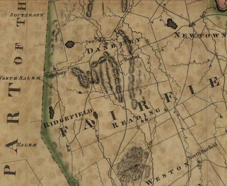
Moses Warren’s map of Connecticut, published in 1812 in Hartford, shows, for the first time, the new route between Ridgefield and Danbury through the Sugar Hollow; Ridgefield village’s two churches in their proper places along the west side of Main Street; also shows “The Crank” in Ridgebury [the section along George Washington Highway that was once ceded to Danbury, but was returned to Ridgefield]; one of last maps to show Ridgefield extending to New Fairfield.

Search

More Posts

Scott House Journal, September 2025

This edition of the Scott House Journal features Clarence “Korky” Korker and the photographs of Ridgefield he captured, now being digitized by the Ridgefield Historical Society.

The Scott House, headquarters of the Ridgefield Historical Society was a buzz this summer with thirteen summer interns working on projects including Battle of Ridgefield and Civil War Research and our Oral History Project.

Meet the Historical Society’s Summer Interns

The Scott House, headquarters of the Ridgefield Historical Society, has hosted more than a dozen interns this summer working on research, collections and social media. Meet the interns and see

Send Us A Message